Project 1: San Diego Collision EDA
Why it matters?
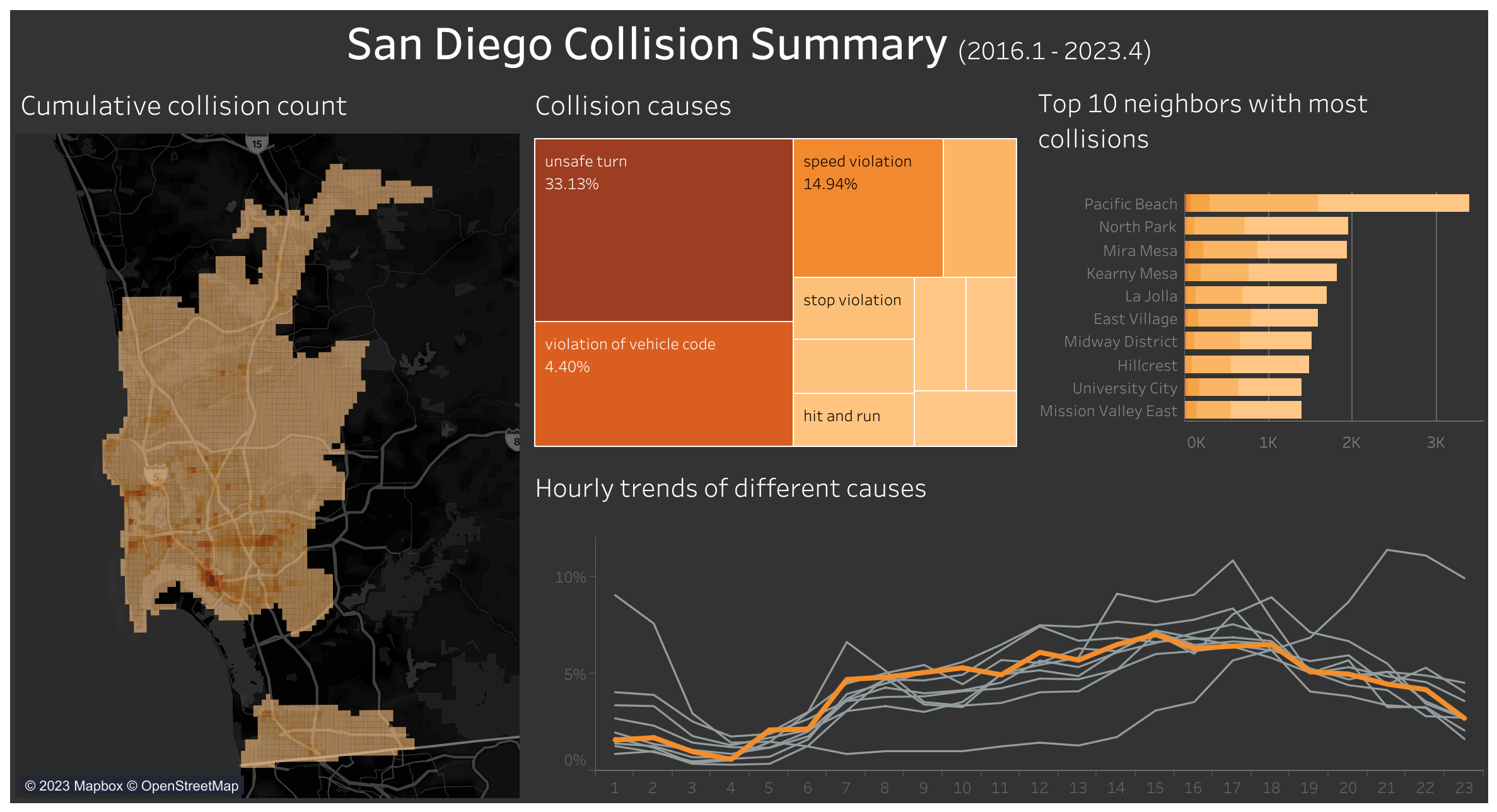
In Korea, car navigation systems notify drivers when they enter ‘accident-prone areas,’ helping them stay alert and avoid potential accidents. However, similar services are not commonly available in navigation systems in the US. As a result, I became curious about identifying accident-prone areas in San Diego to raise awareness when I drive in the future.
Moreover, as an inexperienced driver, I have been told lane changes are the most challenging task when driving in Korea, partly due to narrow lanes. With the wider lanes in the US, I am interested in investigating whether lane changes are still the most challenging task or if other actions demand greater caution.
Overview
- Used Traffic Collisions - basic reports and Police Beats from City of San Diego Open Data Portal and grid map of San Diego from SanGis
- Applied geocoding to unique addresses using Python and Google Geocoding API and stored them in SQLite database
- Created interactive visualization with Tableau so that viewers can look at specific locations in San Diego County
Data Collection
Original dataset
1. Traffic Collisions - basic reports
The following are sample rows from the dataset that contains records from 2015 January to 2023 May. It’s downloaded from the City of San Diego Open Data Portal.
| report_id | date_time | police_beat | address_no_primary | address_pd_primary | address_road_primary | address_sfx_primary | violation_section | violation_type | charge_desc | injured | killed | hit_run_lvl |
|---|---|---|---|---|---|---|---|---|---|---|---|---|
| 171111 | 2015-01-14 20:00:00 | 835 | 4200 | JUNIPER | STREET | MISC-HAZ | VC | MISCELLANEOUS HAZARDOUS VIOLATIONS OF THE VEHICLE CODE | 0 | 0 | MISDEMEANOR | |
| 192016 | 2015-03-19 12:00:00 | 622 | 5200 | LINDA VISTA | ROAD | MISC-HAZ | VC | MISCELLANEOUS HAZARDOUS VIOLATIONS OF THE VEHICLE CODE | 0 | 0 | MISDEMEANOR | |
| 190012 | 2015-03-24 03:05:00 | 626 | 1000 | W | WASHINGTON | STREET | 22107 | VC | TURNING MOVEMENTS AND REQUIRED SIGNALS | 2 | 0 | nan |
| 191866 | 2015-03-27 23:56:00 | 613 | 2800 | WORDEN | STREET | 22107 | VC | TURNING MOVEMENTS AND REQUIRED SIGNALS | 1 | 0 | nan | |
| 185207 | 2015-07-06 11:45:00 | 813 | 2800 | EL CAJON | BOULEVARD | 20002(A) | VC | HIT AND RUN | 0 | 0 | MISDEMEANOR |
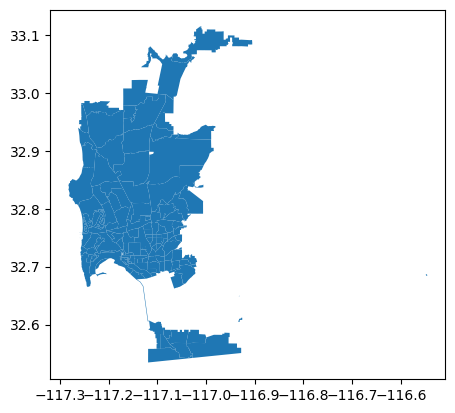
2. Police Beats
The following are the mapping of police_beat values from the above dataset into neighbor names in San Diego. It also contains the shp files of each neighbor.
| beat | neighborhood |
|---|---|
| 111 | Clairemont Mesa East |
| 112 | Clairemont Mesa West |
| 113 | Bay Ho |
| 114 | North Clairemont |
| 115 | University City |
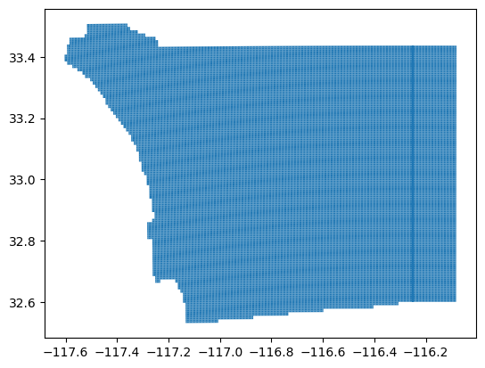
3. Grid Map of San Diego
The following is a sub-grid of the Regional Public Safety Geodatabase’s Public Safety Grid. Each grid is about 0.3 miles * 0.6 miles (width * height).
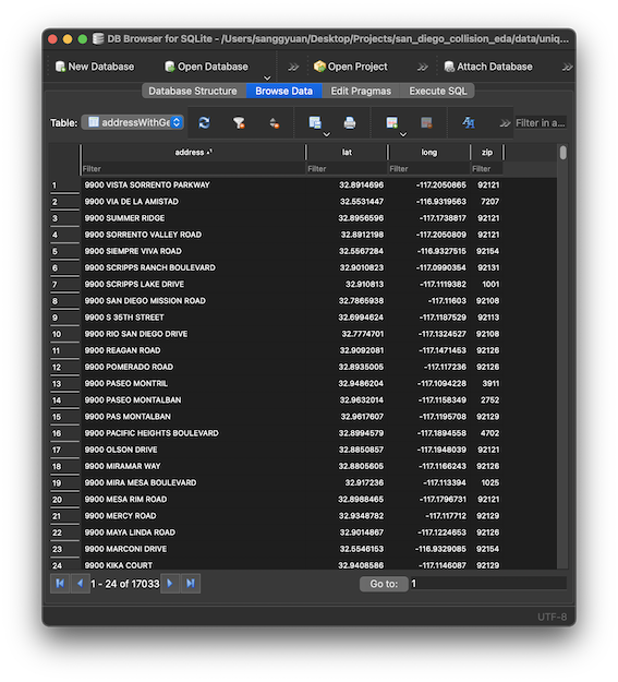
Geocoding
Used this script to geocode addresses using Google Geocoding API and store in a SQLite database.
Data Cleaning
1. charge_desc Mapping
Because charge_desc (charge description) values in the Traffic Collisions - basic reports are hand recorded by different police officers, different abbreviations and wordings are used throughout the rows. Thus, I needed to group them into higher-level categories. Below is a sample mapping.
| original_cause | abbreviate_cause |
|---|---|
| DRVG WITHOUT VALID DRVR’S LIC (M) | without valid license |
| TURNING MOVEMENTS AND REQUIRED SIGNALS | unsafe turn |
| HIT AND RUN RESULTING IN DEATH OR INJURY(IBR 90Z) | hit and run |
| PEDESTRIAN NOT TO SUDDENLY ENTER PATH, ETC | pedestrian |
| FAIL TO STOP AT LIMIT LINE AT RR CROSSING (I) | stop violation |
2. Geocoding Cleaning
Google Geocoding API was unable to locate some addresses due to incorrect addresses and interpret Spanish abbreviations such as CAM for Camino and CMT for Caminito. Thus, I needed to confirm those by hand.
3. Shape File Cleaning
Since I’m only interested in collisions in San Diego, I used the shp file from Police Beats to only extract grids that overlap with polygons from Police Beats.
# using intersects() from geopandas
extract_necessary_grids = [np.any(police_beat['geometry'].intersects(g))
                                for g in sd_grid['geometry']]
sd_grid_trim = sd_grid[extract_necessary_grids]
Visualization